Graça is one of Lisbon's clearest hilltop history lessons. Its views, street plan, convent buildings, and workers' housing still show how the city changed.
Above Alfama and Mouraria, it feels old without being frozen.
The Ancient Roots of Lisbon’s Highest Hill
Graça's height shaped its role before it became a named neighborhood. From the upper slopes, residents could watch the Tagus, the castle ridge, and the eastern approach roads.
Roman and Islamic Lisbon both favored defensible ground. The hill was practical land for lookout points, gardens, farms, and routes between fortified and religious sites.
The 1755 Earthquake and Graça’s Survival
The 1755 earthquake damaged Lisbon unevenly. Low areas near the river faced shaking, fire, and tsunami flooding, while Graça's elevation avoided the worst water damage.
The hill was not untouched, but its churches, convent precincts, and street pattern survived more visibly than the downtown grid that followed the Baixa Pombaline rebuild. The disaster pushed Lisbon into two futures: planned reconstruction below and continuity on the eastern heights.
The Industrial Era: Workers’ Vilas and Social Change
Graça's most distinctive housing story arrived in the late 19th and early 20th centuries, when Lisbon needed compact homes for workers near factories, workshops, and tram routes. The answer was the vila: a small housing enclave organized around a lane, courtyard, or semi-private passage.
Vila Berta is the best-known example because it looks more ambitious than basic workers' housing. Its balconies, tilework, iron details, and controlled street frontage show how social housing could carry architectural pride.
These vilas placed families, small trades, and neighborly courtyards beside convent walls and viewpoints. That mix is why Graça still feels lived-in rather than purely monumental.
Graça's calçada (traditional cobblestone) streets can be slick after rain. Wear shoes with grip, especially on the steeper lanes between the vilas and the viewpoints.
Religious Landmarks: The Augustinian Legacy
The Augustinian presence gave Graça its name, anchor, and urban rhythm. The Convent of Graça shaped landholding, movement, and devotional life on the hill.
Religious estates influenced streets and open space. Even after Portugal suppressed religious orders in the 19th century, the convent complex and church square remained a neighborhood center.
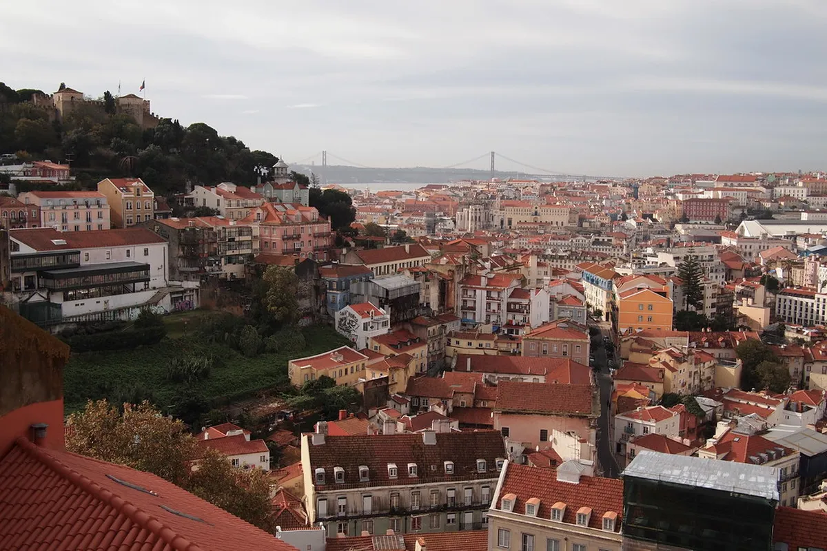
The Evolution of the Miradouros (Scenic Viewpoints)
Graça's viewpoints began as practical high ground. The same slopes that helped observers read the river, walls, and eastern approaches later became public leisure spaces.
The Miradouro da Graça frames the castle, Baixa, and the Tagus, while Senhora do Monte gives a broader panorama. Their appeal comes from Lisbon turning defensive topography into civic scenery.
Graça vs. Alfama After the Earthquake
Graça and Alfama are neighbors, but they did not evolve in the same way after 1755. Alfama kept a maritime identity, with lanes dropping toward the river, fado associations, and heavier visitor pressure.
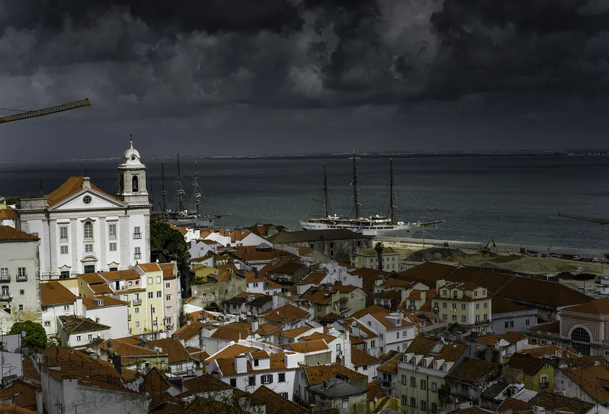
Graça stayed more uphill and domestic. Its convent lands, workers' vilas, tram stops, and viewpoints made it a residential balcony above old Lisbon.
The contrast helps on the ground: Alfama feels like a surviving maze below the castle, while Graça feels like a hilltop community that absorbed religious power, industrial housing, and renovation.
Modern Graça: From Traditional Hub to Creative Haven
Transport changed Graça as much as architecture did. Tram 28 and bus routes softened the hill's isolation, making the climb easier for workers, shoppers, students, and later visitors.
That access helped bakeries, repair shops, renovated apartments, guesthouses, and studios share the same streets. In 2026, Graça still feels local while drawing buyers and creatives.
The pressure is real. Buildings without lifts, narrow streets, limited parking, and rising renovation costs all shape who can stay.
Essential Historical Landmarks to Visit in Graça
A good historical walk starts at the Convent and Church of Graça, then moves to Miradouro da Graça for the relationship between hill, castle, and river. Continue toward Senhora do Monte for the lookout context.
Vila Berta deserves a slower detour. Look for its controlled scale, decorative balconies, and housing-as-streetscape design.
For context, connect the route with the broader story of the 1755 earthquake's impact on Lisbon's old quarters. Graça makes more sense beside the districts rebuilt, flooded, or redesigned below it.
- Start before 10:00 for quieter viewpoints and easier tram boarding.
- Wear shoes with grip; calçada stones can be slick after rain.
- Keep the route flexible because side streets and courtyards carry much of the history.
Arrive at Miradouro da Graça before 10:00 to enjoy the castle and Tagus views without the midday crowds. Tram 28 also runs less packed in the early morning, making the climb up to Graça much easier.
Frequently Asked Questions
How did the 1755 earthquake affect Graça?
The 1755 earthquake caused less damage in Graça compared to the lower districts. Its high elevation and limestone foundation protected many buildings from total collapse. You can learn more about this in the impact on old quarters guide. Most structures remained standing while the valley flooded.
What are the 'Vilas' in Graça's history?
Vilas are specialized housing complexes built for industrial workers in the late 1800s. These gated communities provided safe and sanitary living spaces near factories. Vila Berta is the most iconic example, featuring beautiful ironwork and tiled facades. They represent a significant era of social reform in Lisbon.
Why is Graça called a hilltop neighborhood?
Graça sits atop the highest of Lisbon's seven hills. This geographical position defined its role as a defensive outpost and later a religious center. The steep climb to reach it offers unmatched views of the city. It remains one of the most prominent landmarks in the capital's skyline.
Graça's history is a layered record of religious land, earthquake survival, workers' housing, tram access, and viewpoints turned into public space.
Its streets show a city that endured catastrophe, expanded socially, and now negotiates popularity without losing its local scale.
For related Lisbon old-quarter deep-dives, see our Alfama: Lisbon's Oldest Neighborhood and Mouraria — Lisbon's Moorish Quarter guides.